Monday, October 8, 2012
October 1: Camping Out
On the 30th, we left Bluff taking the well wishes of our campground hostess and the Navajo Twins
with us. We even paid our respects to the Mormon pioneers of the Hole-in-the-Rocks expedition who build the settlement of Bluff City in the 1880s.
We headed back to Blanding to post some blogs and stock up on supplies, but not beer. We were headed into Cedar Mesa country and hikes into the Grand Gulch Primitive Area. We would be forty miles from the nearest store or gas station. And not much closer to any kind of drinkable water.
We had contemplated hiking in Grand Gulch in August, you may remember. But 100º heat in the deep canyons of Grand Gulch was way more intimidating than the same heat in Moab. The sign on the BLM Ranger Station clearly read: There is no water in Grand Gulch. It takes four miles just to get into Grand Gulch and there is no easy way out. Grand Gulch is 32 miles long and there are only a few (five?) access and egress points along the way--all hard to reach.
Yet Grand Gulch was a Basketmaker and Anasazi metropolis of sorts. It is littered with ruins and rock art from 1,000 to 2,000 years ago. It was a prime target for early explorers and archaeologists like Richard Wetherill and the Hyde Expedition for the American Museum of Natural History in New York City. These sites (such as remain) can still be visited by those intrepid enough to hazard the rigors of one of the wildest canyons in Utah. It is one of those places that serious hikers want to list in their portfolios.
Anyway, we saved it for last. The weather was now cooler, and there was some stagnant standing water after the earlier rainfall.
We wanted to camp overnight at Natural Bridges National Monument. True, it lacked water, except for the restrooms at the Visitor's Center and a single pump to resupply backpackers within a forty-mile radius. No fooling: Natural Bridges has the only water pump on Cedar Mesa. And no store. We were well stocked with cans of chili, chips and dip, eggs, and canned spinach. (A nod to Popeye.)
Unfortunately, the 13 sites at the campground were full by the time we got there. But the helpful woman at the Visitor's Center cheerfully suggested that the primitive campsites were really "quite nice."
We drove up the Bear's Ears Road, the dirt track up the mountain to the landmark. Actually, it turned out to be quite fun. The site we found was not on the ears, more like the bear's rear.
But we were alone among the Utah Junipers. (We hoped.) No mountain lions; no coyotes; no bikers; only old people.
Up to this point, I am proud to say, we had not built a single fire at our campsites. I have never understood the male compulsion to build a fire as soon as he pitches his tent or stops his RV, even if the combustible material consists of scrap lumber or cardboard covered with plastic. (We once camped next to a young man who could not figure out why the branches he had just cut off a living bush would not burn--even when he kept pouring lighter fluid on them.) But this time, it was cold and we decided to build a fire. Legal or not, (there were fire-pits at the campsites) we gathered dead juniper wood lying on the ground. Dry juniper wood makes a great, long-lasting fire, with a sweet smell. I thought I was quite inventive in using the stones lying around the campsite to build a radiant shield.
We had heat for much of the night.
When we woke the next morning, it was 41º. It was not August anymore.
September 29, Part Two: Wonders Woven with Rock
Rock art specialists believe that the Butler Wash petroglyph panels were created by the Basketmaker II people living along the San Juan River. This would place the panels between 500 B.C. and 450 A.D. There may even have been an overlap with the Barrier Canyon culture. I personally believe that the Basketmaker II culture strongly influenced (joined?) the nascent Fremont culture and that the later ancestral Puebloan rock art reflects the vision of a different group of immigrants to the area. (Remember Richard Wetherill's astute deduction of a difference between Basketmakers and Anasazi?)
This panel is located at the mouth of Butler Wash, just above the San Juan River to the south. It is the largest and most important Basketmaker II series of petroglyphs, and other examples of this style are found in almost all the "washes" downstream along both sides of the San Juan River all the way to the Colorado River junction. This includes images and remains found in Grand Gulch that cuts through Cedar Mesa, our next destination.
The panel can usually only be viewed by boaters on the San Juan River, including kayakers and rafting expeditions.
I have a great aversion to small boats, especially those heading down white water. So Janet and I went overland. Technically, this is not hiking but trespassing. The trail runs across a 100-yard stretch of private land just before the main panel, but the land is unoccupied and we tiptoed very quietly and stepped on no plants.
We did pass an ancient Cottonwood that was fenced off in honor of its seniority.
After paying our respects, we continued on to a small Basketmaker panel that served as a sort of teaser.
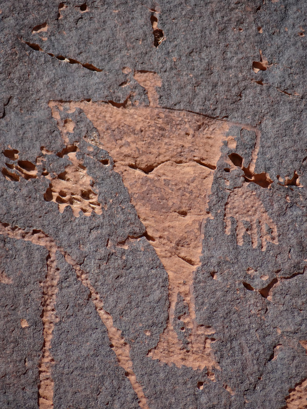
Unfortunately, the BLM had let weeds grow up around it and most people probably miss it, although the graffiti is a give away. We found some large logs to level the weeds (they cannot be killed anyway) and took some close-ups. You can see the distinctive square shoulders and strange headdress.
The appendage coming off the neck puzzles even the specialists. The figure is clearly male. To the right was a more realistic figure throwing an atlatl (used by Basketmakers before the coming of the bow and arrow).
This suggests to me that the large figures are supernatural figures, not ordinary humans. The atlatl figure is surrounded by a serpent and maize plant.
The Basketmakers were the first culture north of the San Juan River to begin cultivating maize, although not as extensively as the Anasazi.
Once we arrived at the panel, we were greeted again by the BLM (who assumed we were coming by water, not land).
There, about 100 feet above the level ground, was a magnificent panel. Two young lads beat us there.
(Several young families had rafted down the river to this location.
Others were kayaking to the site.
One of the fathers told me that his friends had counseled him not to miss the opportunity to experience the power of the images. Others in the family were picnicking, waiting, I think, for us to stop taking photographs and studying the images.)
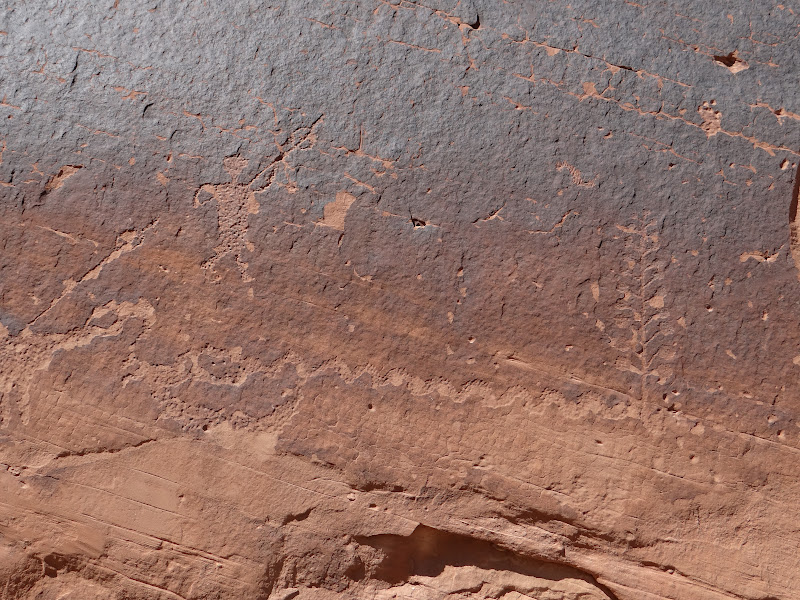
The main panel may have been about 150 feet long, but figures continued to appear along a quarter-mile stretch of cliff face.
I have seen many photos of the main panel, but was unprepared for the impact of the actual site. It rivaled the Great Gallery in Horseshoe Canyon.
The massive figures were more than lifesized.
The layers of symbolic power above their heads speak of greater-than-human control of human destiny.
Their featureless faces contrast with the prominence of hands and legs. Janet is the first person, I believe, to notice that most figures are holding their hands with the backs toward us
--very provocative. Again, there is a clear distinctive between males and females, who have skirts or sanitary coverings without male genitalia. Smaller figures overlay the large ones. We show the same sort of garments and shoulders in the later Vernal Fremont panels far to the north.
And, once again, the strange keyhole-shaped geometric ovals--that we show in the Comb Ridge canyons--turned up.
You may have noticed that some of the figures had animals either decorating their chests or somehow inside them. Notice that this figure has an anthropomorphic figure on or within his chest.
The figures with trapezoidal bodies and large hands look like figures we show months earlier in Shay Canyon and Moab.
And this little guy was almost unnoticed.
Could this be R2D2? Evidence of extraterrestrials? Or an earlier life of George Lucas? Either way, the force
must have been with the Basketmaker artists. It was certainly with us.
Our hike to River House Ruins and the Butler Wash Panel covered about 9 miles. Tired, we drove back the Comb Wash Road. At one point the Jeep bounced hard coming out of one of the water-covered crossings. But I kept my wheels spinning until the road we were on ended at the foot of Comb Ridge. Looking at the mountain a few feet in front of us, we were worried about being lost. Darkness was approaching. Then I realized we were stopped next to the sign for the Hole in the Rock Trail, where I had earlier conversed with the considerate fundamentalist missionary, who had stopped to give us directions. Now I know the direction back. The force was with us after all.
September 29, Part One: Baptized in Mud
I need to make a clarification. One of our main goals was to drive down the Comb Wash Road to visit the River House Ruins and, we hoped, hike to the Butler Wash Panel, an extremely important Basketmaker II petroglyph panel. Would they live up to our expectations, we wondered.
More to the point, it rained hard on Monday. (Remember the 7-inch annual precipitation in the Bluff City area?) I knew that the four-mile Comb Wash Road crossed the wash several times and decided to wait until Saturday to make the effort, figuring the wash would be drier by then.
The drive there passed the serpentine talus slope of Lime Ridge.
Navajo mythology claims that this was actually a mythical serpent waiting to be brought back to life. The prevalence of serpent images lends authority to this sort of belief.
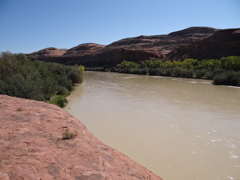
At the end of the road is the San Juan River
on its way to the Colorado River and serpentine in its own right a few miles downstream at Goosenecks State Park, where it makes a series of at least five spectacular turns, one right after another.
Only an aerial photo could capture this spectacular site.
The Comb Wash Road was narrow and sandy.
I was pleased at how easily our Cooper A/T 3 tires handled the sand. I even crossed a muddy section of the wash, and my confidence in the Jeep grew. About a mile along the road, we stopped at a fork. One rough road was labeled the "Hole in the Rock" trail, after the 1880 Mormon pioneers who built it. Just then, another Jeep (a Wrangler) ploughed by us and stopped. Its tires were caked with mud. Out stepped a gentleman about our age and also in good shape. OK. Turns out he is a Christian missionary in Mexico, vacationing in the area. This was his last day before returning to Mexico, and he was coming from River House Ruins.
"You can drive right up to the ruins," he reassured me, as I looked at his tires. "Only be sure to watch out for the 100-yard stretch of road that crosses Comb Wash (actually, it is Comb Wash!). It's muddy and you have to keep your wheels moving." I thanked him for the advice. He had once been in the Lancaster County area. My wife and I were looking at rock art, I replied. Thus ended our theological dialogue.
The drive to River House turned out to be almost as much fun as the drive back. It was muddy, when it was no longer sandy.
I guess the wash had not yet dried out. There were at least eight river "crossings" like this one.
The Jeep kept the tires going forward, even when we had to climb a three-foot bank out of one of the washes. When the road ran out of sand and mud, it turned into rock and slickrock.
By the time we returned, the Jeep had mud on the roof, as well as sides.
I have not washed it since--out of sheer pride and a desire to fit into the culture.
Oh yes, we made it to River House. On the way, we passed an old trading post,
from the 1880s.
The ruins were spectacular.
The BLM was very welcoming,
expecting most visitors to arrive via commercial river expeditions. We were lucky in that we were quite alone as we climbed up to the site.
A couple of boulders guarded the ruins.
The tower kiva was still intact,
as were the multi-storied residential structures.
It reminded us of Balcony House on Mesa Verde.
But it overlooked the river, rather than a canyon.
On the alcove ceiling above the ruins was a very large (8-foot) Anasazi snake.
There were other pictographs as well,
including the usual mountain rams
--sort of strange given the setting of River House.
Several of the original doorways showed the influence of Chaco Canyon style
and the kiva had considerable smoke stains
and original plaster.
We stayed in the ruins as long as we dared. But eventually we had to move on to the Butler Wash Petroglyph panels, a couple of hiking miles up the San Juan River.
Subscribe to:
Posts (Atom)