Monday, October 1, 2012

September 23, Part Two: Hoodoos the Voodoos that You Do's?


Did I say that Bryce is popular?  It was late September and it was still hard to find parking spaces and dodge tourist buses--again, mostly European tourists, but some Japanese.  But our favorite was a group of African-American church ladies (Upon seeing a photographer at the edge of the rim, one lady exclaimed:  "Look at him!   Lord, Jesus, no way, no how."  Even her companions were amused.)  Sure enough, checking out their bus we saw it was a tour out of Baltimore.

Bryce is worth a visit.  The orange pinnacles are called "hoodoos" and contrast brilliantly with the green canopy of spruces and firs.


It is a great splash of color, like orange popsicles gone wild.


Cameras were popping everywhere and mine too.


I liked the white caps.


It was a great opportunity to play with telephoto images.


With so many hoodoos, it was hard not to burst into Cole Porter songs or Dr. Seuss versicles.

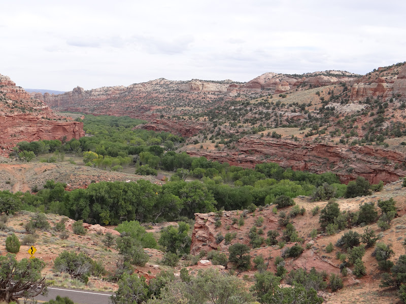
We headed back to Capital Reef area in the early afternoon.

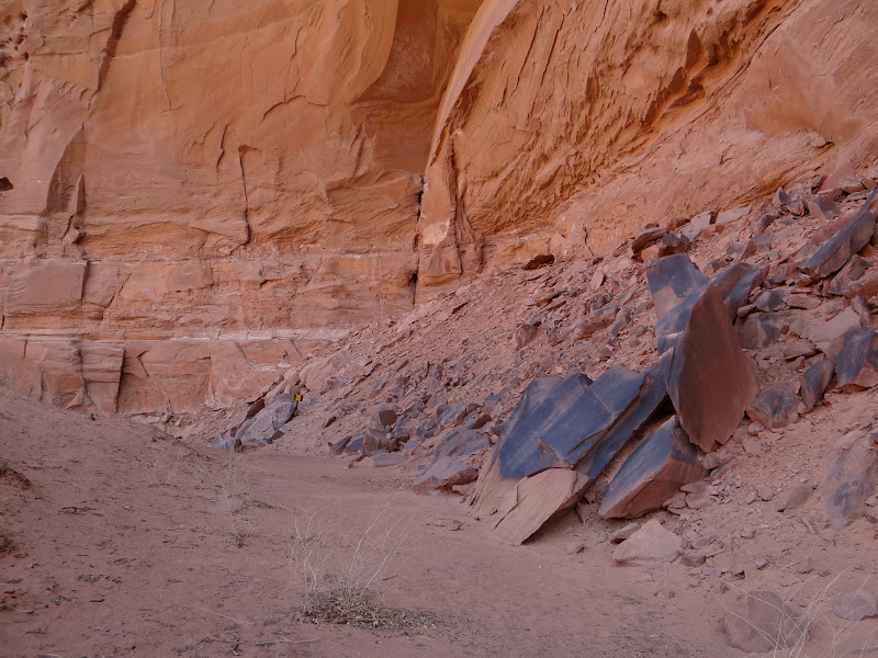
But before we camped for the night, we stopped at two rock art sights.

The first is called the "Hundred Hands" panel and is located in the Escalante River Canyon.


A beautiful spot.  The trailhead starts with some pleasant advisories.


We especially appreciated the warning:  "You could die out here."


Gee, thanks for the input.  I think it meant getting run over by an RV--which was trying to park in small lot beside the river that I wanted to get into.

What the park did not say is where to find the Hundred Hands panel.  We found it; way up there.


Can you see the hundred hands?


Now you can.


And so we climbed up and up.  Janet is getting a lot braver about these things.

The name of the panel is a misnomer.  I counted four to five rows of at least 40 handprints.  None of the prints were in pairs and none were the same.


This was a Fremont village that made a statement.  The height of the panel and steepness of the slope made it impossible to get too close, but binoculars and a telephoto lens gave us a good sense of each print.


How they were made is another issue.

In our judgment, the area was fertile (still is) with terraces ideal for farming, which the Fremont did.


Indeed further exploration revealed evidence of granaries (Fremont?) throughout the canyon system.


The location of the panel was also an ideal defensive spot to see movement throughout the nearby canyon system.


(Can you spot our Jeep?)

On the way down, as we carefully maneuvered across some narrow ledge,


we had a surprise.  We did not expect to find a little mountain ram serving as our good luck charm.


Or was it telling us something?

Not content to call it a day, we headed a few miles further north to Pleasant Creek canyon.  Along the trail we spotted some granaries across the river bed.


They were all quite high up.


But about two miles up we found the pictograph we were looking for.  It was about 300 yards away, across the creek and inaccessible.


The Fremont usually did not do pictographs, but this one is a classic.


We expected to see the three warriors, although again it took binoculars to do so.  But what  a surprise when we looked again at the photo.  We did not see the faint Barrier Canyon "rain" figure next to them.

By late afternoon we decided it was time to head north.  The closest campground--the closest anything--was Torrey, Utah, 70 miles away.  Down the valleys of the Grand Staircase we charged.  Cows to the left of us; cows to the right of us; cows ahead of us.  Nope, that's a deer, admiring our headlights as we descend a curve.  Stop short; catch the flying stove with the right elbow.  At least it was not a headlight in the deer.  That little ram really was good luck.

September 23, Part One: Across the Grand Staircase


At the last minute, we decided to continue traveling in a southwesterly direction.  We were within 100 miles or so of Bryce National Park and thought it would be an oversight not to visit this popular park.  Did I say popular?

Between Boulder and Bryce lies the Grand Staircase-Escalante National Monument.  It was just recently awarded that status by Bill Clinton in 1996, much to the anger of local residents and Orin Hatch.  ("The most notorious federal land grab in history," he said--ignoring the fact that most of it was already federal land.)

Part of the deal Clinton struck was to allow existing grazing rights to continue.  And indeed we ran into cows and deer (and even a bear) as we drove through a mountainous stretch.  One time I had to stop so suddenly that all our camping gear came flying into the front seats.  I caught the folding chairs and camp stove before they hit either of us.  Coming back we drove this highway at dusk.  A little nerve racking.

More nerve racking was the incredible changes in scenery and highway conditions every 30-40 miles.  From canyonlands and bluffs, the highway heads up into a mountainous forest covering with yellowing aspens this time of year.  After winding through mountainous terrain, one crosses a 20 mile isthmus with canyons falling off on both sides of the road.  The isthmus (from Boulder to Escalante, Utah) is only as wide as the two-lane highway, and it winds up and down.  Great scenery, but I did not stop to take pictures.  The pull-offs were just that.

South of Escalante, we stopped at a KOA for the night.  A little chilly, but the scenery was spectacular.


September 22: On the Road Again

Today we continued to do some heavy duty traveling.

The first stop on our journey was the Fremont River valley, the little town of Fruita, in particular.  The geology of this region changes every 50 miles.  After passing through a landscape marked by desert and barren badlands, we entered Capital Reef National Park, marked by canyons and huge bluffs.  In the middle of the park is a broad and fertile flood plain filled with orchards:  Fruita.


The Fremont Indians obviously liked this area too--good hunting and good soil for corn.  In fact, their culture--spread from here as far north as Wyoming--was named after the Fremont River culture.

Here at Fruita is a curious set of petroglyphs in a amphitheater setting.


It is a curious matter because the figures resemble Fremont figures we saw earlier in Vernal, Utah, 250 to the northeast--at the McConkie Ranch and McKee Springs.


The Fremont petroglyphs between the two locales (like Nine-Mile Canyon) are totally different.  Go figure.

No hikiing was needed this time.  The highway runs right by it, as do the tourist buses.


This bus was filled with French speakers.  I imagine they are on their way to the Grand Canyon from Moab; or is it Las Vegas?

We liked the way one of the rams was looking at another.


Another seemed to have something to say.


Very animated figures, unlike many stiff animals we often see.  One spooky image was a paw or hand that seemed to emerge out of the rock.


As we got to the quiet town of Boulder, Utah, we stopped at the Anasazi State Park and Museum.  What makes this location unique is that it was the last outpost of Ancestral Puebloan culture, in an area dominated by Fremont culture.


It is called the Coombs site and was excavated just a few decades ago.  The ruins reflect Pueblo I and II cultures:  a mix of pithouses


and small pueblo units


simultaneously gathered together in a village aggregation.


The retention of pithouses was probably due to the fact that they are warmer in winter and cooler in summer that adobe pueblo structures.


September 21: A Great Gallery of Spirits


They lied to us.  The Park Service indicated that the change in elevation to get into and out of Horseshoe Canyon was 750 feet.


The altimeter on my GPS (thanks kids) clearly showed it to be over 1,000 feet.  It took us an hour to climb down.  Once down, it was another 3 miles to the Great Gallery panel, sometimes called, stupidly, the Holy Ghost Panel.  It was not a difficult canyon trail; in fact, quite beautiful,


if a bit sandy.


We were not alone.  Several other groups were co-adventuring, including an elderly couple that was having trouble with the heat and a couple vacationing from Arkansas that was not.  Another couple was headed by a female lawyer whose son works for the National Park Service.  A few others were young adults.  Some of these people had actually camped overnight at the head of the canyon, rather than getting up at 5:00 in the morning to drive overland, as we did.

I mention this because it is refreshing to know that there are people seriously interested in America's ancient heritage.  Not all of them were well informed, but they all engaged in lively conversations with us about what they were witnessing.  I was even pleased to see that the National Park Service provided information and binoculars in a box for the use of visitors to the panels.  Very trusting.

There is no way to describe the plethora of images we studied.  We entered the canyon about 9:00 a.m. and did not return until close to dark.

There were actually 3 major Barrier Canyon pictograph sites before we got to the Great Gallery.  The first one we would have missed if we had not had a special guidebook.


It was behind some bushes, unmarked, and up about 50 feet.  Among the strange figures was the birdlike anthropomorph with "rake" wings.

 
The second site was a little more obvious, since the trail led right beside it.


More strange, abstract anthropomorphs and the usual serpents.


The third site was in a high alcove


and not as impressive.


I think this may have been living quarters.

The Great Gallery, however, took our breath away.  Its location was dramatic, facing a large open space that may have been used ceremonially.


It extended for at least 100 feet


and invited visitors to sit and meditate.  It was as if the spirits depicted were watching us. not as if we were gawking at them.


We were uninvited guests.  The figures were "ghostly" and knowingly silent.


Who or what were they thinking?  Doing?


It was like being confronted by a choir of ancient shamans or rock spirits.


Each one different; each one regal.


For the most part, no arms or appendages.  Just a stare and a surround of spirit figures.  The serpents were not merely at the side, but on the robes of the figures (or inside them, as if X-rayed?).


The eyes were haunting.


But do not think that Barrier Canyon artists could not draw realistic human figures.  They could and did--as in the case of this miniature scene.


But the spiritual, not the literal, was the subject of these representations.  Even the usual mountain sheep were miniature in stature.


Nothing distracted from the powerful gaze and mysterious veiling of the main figures in the panel.

We studied and reflected at the Great Gallery for two hours before realizing that we had to climb out of the canyon before dusk.   The trail up the side of the canyon was not extremely dangerous, but you would not want to trip.  We passed the elderly couple and made sure they had enough water, since the heat was obviously bothersome for them.  As we reached the top, the fellow from Arkansas that we had earlier conversed with came running down the canyon.  He wanted to be sure the couple made it to the top.  Arkansas hero.  His son waited impatiently at the rim.  Only then did the full measure of the day's events dawn on us.  We have thought about that couple quite a bit since.

September 20: Hog Wash


After crossing the northern section of Lake Powell at Hite's Crossing, we stopped at a pull-off at Hog's Spring.  Lake Powell in Glen Canyon is spectacular; but the day was overcast, the lake low, and landscape photography pointless.

We knew that there was one pictograph in the Hog's Spring vicinity that was worth the stop.  It was near the highway, which is UT 95--running from Blanding to Hanksville--a truly scenic highway through majestic landscapes.

Again, we were almost frustrated when we spotted the telltale amphitheater-like alcove.  Can you spot the pictograph in this photo?


One image showed up on the left face of the alcove, about 50 feet up.


It was an ancient Barrier Canyon image of a heavily robed figure with what appears to be a possible "crown."


It is called Cleopatra, but there is no reason to assume it is a female.  That may just be Hog Spring hogwash.  She/he has a quadruped familiar.  We doubted the holes that formed her face, but closer inspection shows them to be heavily weathered and probably pre-historic.


We continued to Hanksville, which is the only "civilization" within a hundred or more miles.  I made sure I always had a full tank of gas and lots of water in the car.  My favorite station was the one chiseled into one of the bluffs in town.


We camped behind a restaurant, next to a canal, and spent most of the time there chasing away mosquitoes, something we had not yet had to worry about in the desert environment.  Our goal was the Horseshoe Canyon district of Canyonlands National Park.  It would require a drive of 32 miles on an unimproved dirt road and a hike of seven miles in a deep canyon.


  But the Barrier Canyon rock art panels there are among the most famous in America,  Horseshoe Canyon used to be called Barrier Canyon; hence the name that defines the most ancient of American rock art styles.

September 19: Our Next Move


The immediate reason for returning to Blanding, Utah, was that I (Bill) had an appointment with the curator at the Edge of Cedars Museum, Deboarah Westfall.  I had wanted to search the rock art data base that had been assembled by Sally Cole (and used for her book, Legacy on Stone).  Ms Westfall was very accommodating and allowed me to use the computer in her office.  I don't know if she expected me to stay there for 6 hours without a lunch break, but she seemed glad someone else was interested.

The documentation of rock art sites was restricted to the area from Moab to Cedar Mesa--precisely the area I was concentrating on.  Although the database was not complete, it still contained more than 250 separate sites, many of which have four or five or more panels--thousands of individual images.  Each site was carefully drawn.  Although the database was not very specific about exact locations, I was familiar with many of them.  I came away with 15 pages of notes that will help me assemble a more complete profile.

The other reason for returning to Utah was that our time was running short and now we had to concentrate on the really serious sites, some of which would require extensive hiking (or rough driving).  The weather was turning a bit cooler (90s in the afternoon), which made it more practical for us to go into canyon country.

The sites we absolutely had to visit included the Great Gallery in Horseshoe Canyon, the Procession Panel on Comb Ridge, the Butler Wash Petroglyphs on the San Juan River, the Fremont Petroglyphs in Capitol Reef National Monument, and sites in Grand Gulch Primitive Recreation Area. To visit these sites, we would have to cross Glen Canyon and travel back and forth between southcentral and southeastern Utah.